Protect yourself and vehicle: Know flood prone areas through NOAH
Project NOAH also details landslide and storm surge prone areas
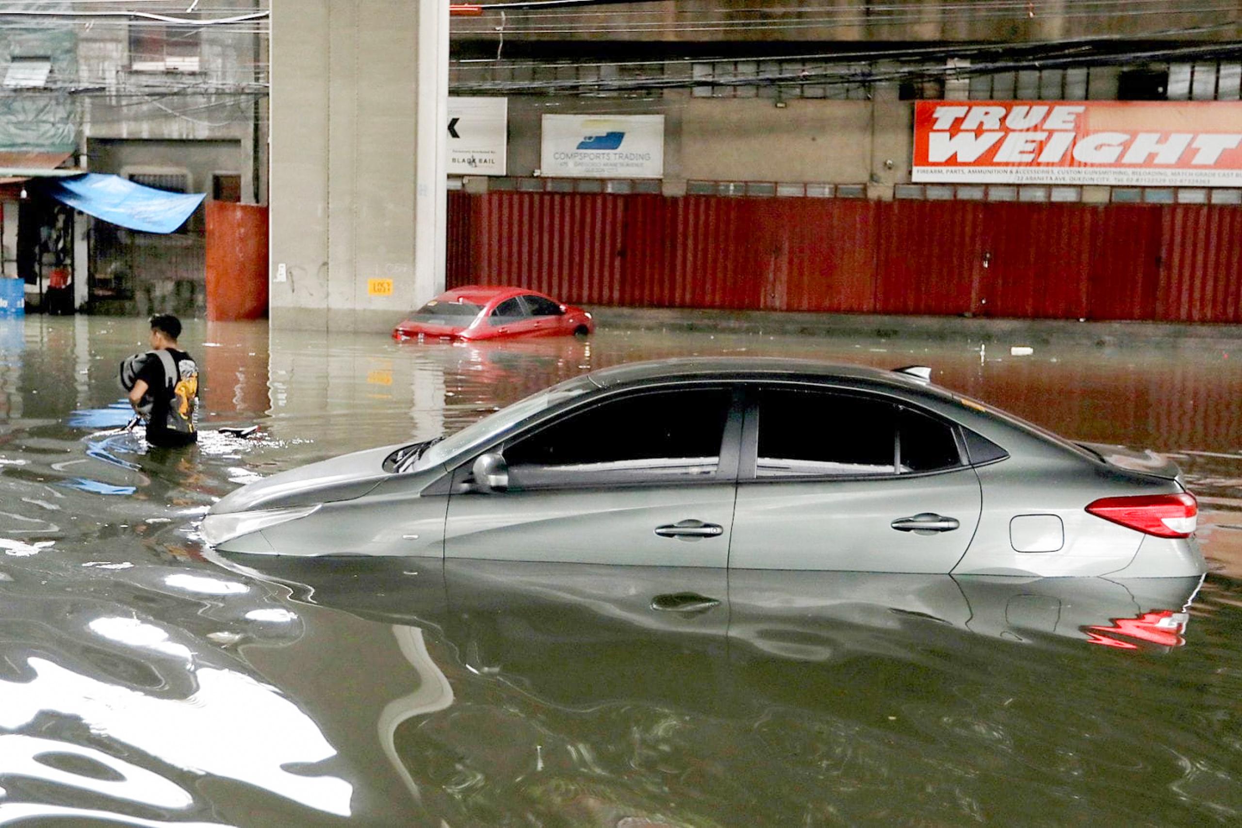
The Philippines is no stranger to floods. With the strengthening Southwest Monsoon (Habagat) affecting the country significantly during the rainy season, extensive flooding is now expected to affect numerous regions.
For individuals with critical errands or those who are required to report to work amidst inclement weather, identifying Metro Manila’s (or other regional) flood-prone areas is paramount. This awareness can help prevent being stranded and significant repair expenses should your vehicle get submerged in floodwaters.
Enter Project NOAH.
Responding to a call from then-President Benigno “Noynoy” Aquino III for improved disaster preparedness, the Department of Science and Technology (DOST) launched Project NOAH (Nationwide Operational Assessment of Hazards) in 2012. This program is aimed at providing a more effective system for preventing and mitigating disaster impacts in the country. It is now managed by the University of the Philippines through its NOAH Center.
Basically, Project NOAH combined various technologies like sensors, mapping, and forecasting tools to give communities and authorities better, faster, and more accurate information about floods, landslides, and storm surges, aiming to save lives and reduce damage.
Know flood-prone areas
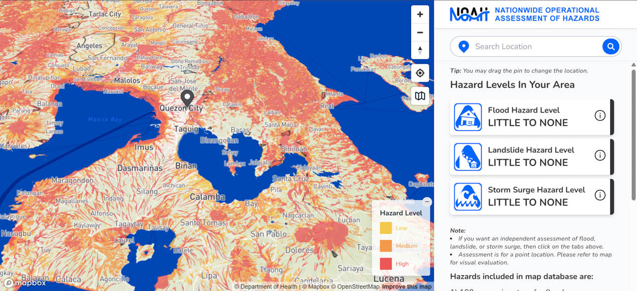
Before hopping in your car or pickup during inclement weather like we have today, try visiting Project NOAH’s portal at www.noah.up.edu.ph or the Project NOAH mobile phone app. The system will then generate a detailed map, utilizing distinct color highlights to represent areas of low, medium, and high hazard levels.
From this information, you can then decide to push through and find alternative routes, or postpone your trip entirely until the weather improves.
A significant benefit of checking Project NOAH during severe weather is its detailed mapping of low-lying flood-risk areas. This insight helps you make smarter choices, even for seemingly minor plans like selecting a restaurant or parking your car, to avoid getting caught in rising waters.
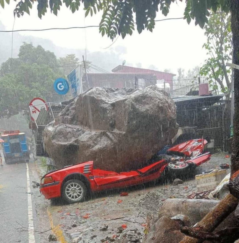
Storm surge and landslides
Beyond just flood mapping, Project NOAH empowers users with comprehensive hazard information through its NOAH Studio (www.noah.up.edu.ph/noah-studio). This platform allows detailed exploration of areas prone to storm surge, landslides, and volcanic eruptions. Users can also navigate specific maps for each hazard and locate essential community resources like police and fire stations, hospitals, and schools designated as evacuation centers.
While verifying information with Project NOAH and other reliable news outlets is a must before travel, remember to wield prudence above all else during times when Mother Nature speaks her mind.
Related Posts

MIAS 2026: Inside the aftermarket side of this year's auto show
The aftermarket section at MIAS showcases options for car enthusiasts to personalize, enhance, and maintain their vehicles

MIAS 2026: What we saw at the custom and classic car area
We take a look at some of the entries in this year's MIAS Classic and Custom Car Competition

Are electric hypercars becoming dangerously quick?
Ferrari is addressing the near-instant acceleration of electric vehicles that can reach levels that are disturbing to the human brain.

Six things to plan ahead for 2026 Manila International Auto Show
Heading to the 2026 Manila International Auto Show? Here are some tips to make sure you maximize the experience at World Trade Center

First Impressions: Did 2026 Nissan Kicks e-Power get the right updates?
Did Nissan do enough to keep the Kicks e-Power competitive in the hybrid crossover segment with its new update?

2026 Toyota RAV4 HEV: The promised hybrid?
Is the all-new sixth-generation Toyota RAV4 HEV worth it at a starting price of PHP 2.183M?